How are cables, gas pipes and water mains located before digging?
Underground cables, gas pipes and water mains can all occupy the same construction corridor, but they are not necessarily located using the same method. The most suitable approach depends on the material of the buried asset, whether it can carry a detectable signal, the availability of access points or tracer wires, ground conditions, burial depth and the level of certainty required before excavation begins.
For that reason, underground service locating is normally a staged investigation rather than a single scan. Plans and visible site clues provide context, electronic locating may trace suitable assets, ground penetrating radar can add subsurface information, and potholing can physically verify critical services where required. Understanding how these methods differ is particularly important when a project involves several utility types within the same work area.
What should happen before underground services are located?
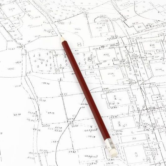
The locating process should begin with the information already available for the site. Before You Dig Australia connects people planning excavation with participating infrastructure asset owners so relevant plans and service information can be reviewed before ground is broken. These records can indicate which networks may be present and where they are expected to run.
Plans are a starting point rather than proof of the exact position of every buried asset. BYDA notes that not every infrastructure owner is a member of its service, so the plans received should not automatically be treated as a complete record of everything underground. Private services, altered alignments and undocumented infrastructure may also be present.
A site inspection adds another layer of information. Pits, valves, hydrants, meter boxes, marker posts, cabinets, service entries and evidence of previous trenching can all provide clues about where buried infrastructure may run. SafeWork SA includes visual inspection, cable locating and potholing within its guidance for locating underground utilities before excavation.
Smooth Flow Hydro provides underground service locating across Adelaide and regional South Australia for projects that need buried infrastructure investigated before excavation, trenching or drilling.
How are underground electrical and communications cables located?
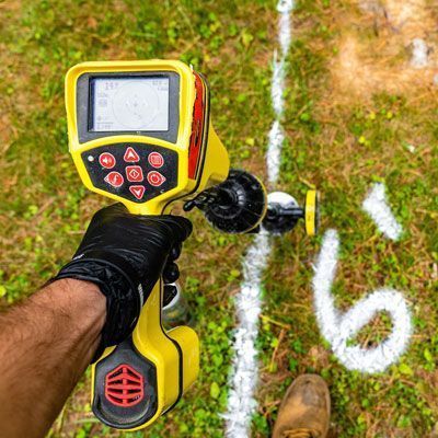
Many underground electrical and communications services can be traced using electromagnetic locating equipment. This method works by detecting a signal associated with a conductive cable or with a conductive component that runs alongside the service.
Electromagnetic locating
Where a suitable connection point is available, a transmitter can apply a signal directly to the target service. In other situations, a clamp or induction method may be used to place a signal onto the line. A receiver is then moved across the site to follow the signal and estimate the horizontal alignment of the buried cable.
Passive locating can also identify some services that are already emitting a detectable electromagnetic field, although relying on passive detection alone is not suitable for every investigation. The method used should reflect the cable type, site conditions and available access points.
Depth estimates can sometimes be obtained from locating equipment, but they remain interpreted electronic measurements. Where the exact physical position of a cable is critical to the proposed excavation, potholing may still be required before machinery works nearby.
What if the cable cannot be traced clearly?
Some cable systems may be installed inside conduits, grouped with other services or located in congested corridors that make individual signals difficult to separate. Ground penetrating radar may provide additional information about conduits, duct banks and other buried features where site conditions are suitable.
Using more than one method can be particularly useful where several utilities cross the same area. Smooth Flow Hydro's cable locating services support projects that need electrical or communications infrastructure identified before construction proceeds.
How are underground gas pipes located?
Gas pipelines require a different approach because the ability to locate them electronically depends heavily on the pipe material and installation. Metallic gas pipes can often be traced using electromagnetic locating when a suitable connection or detectable signal is available.
Plastic gas pipes do not conduct an electromagnetic locating signal in the same way. Some installations include a tracer wire or another conductive component intended to make the service traceable. Where an accessible tracer is present and functioning, a locator may be able to apply a signal to it and follow the route of the gas service.
If a non-metallic gas line does not have a usable tracer wire, the investigation may require other evidence. Plans, marker posts, meter positions, service entries and ground penetrating radar can help build an understanding of the likely alignment, although GPR performance varies with target size, depth, soil conductivity, moisture and surrounding materials.
Because gas infrastructure can present serious consequences if struck, locating results should be considered alongside the relevant asset owner's requirements. Where exact position is required, the service may need to be physically exposed using the potholing method permitted for that asset.
Smooth Flow Hydro provides gas pipe locating services for South Australian civil and commercial projects where buried gas infrastructure needs to be investigated before excavation.
How are underground water mains and water pipes located?
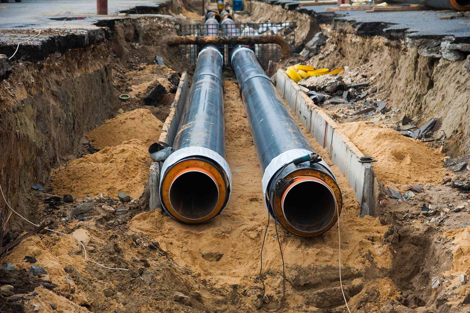
Water infrastructure can be made from a wide range of materials, so there is no single locating method that applies to every main or service connection. Older networks may contain metallic pipework that can be suitable for electromagnetic tracing, while newer systems may include PVC, polyethylene or other non-metallic materials.
Locating metallic water mains
Where a water main or associated component is electrically conductive and a suitable access point is available, electromagnetic locating may be used to trace its alignment. Valves, hydrants, meters and other visible fittings also provide valuable context when comparing electronic results with the expected network layout.
Locating non-metallic water pipes
Non-metallic water pipes cannot normally be traced simply by applying an electromagnetic signal to the pipe material itself. If the installation includes an accessible tracer wire, that tracer may be used to follow the service. Where no traceable component is available, ground penetrating radar may assist in suitable ground conditions by detecting the contrast between the pipe, its contents, bedding and surrounding soil.
GPR does not guarantee detection of every plastic or non-metallic pipe. A deep, small-diameter pipe in conductive or saturated soil may be considerably harder to distinguish than a larger pipe in dry, lower-conductivity ground. Plans, surface features and other locating methods therefore remain important.
For projects involving buried water infrastructure, Smooth Flow Hydro provides water main locating services across Adelaide and regional South Australia.
Why can one locating method not find every utility?
The key difference between underground utilities is not simply whether they carry electricity, gas or water. The locating response is influenced by the physical construction of the asset and the conditions around it.
Factors that can change the most suitable method include:
- whether the service is metallic or non-metallic
- whether a tracer wire or conductive component is present
- whether there is an accessible connection point
- the depth and diameter of the buried asset
- soil type, moisture and electrical conductivity
- surface materials such as reinforced concrete
- the number of nearby utilities and the level of underground congestion
- the accuracy and age of available asset plans
- whether the service needs to be approximately located or physically verified
This is why professional locating usually combines evidence rather than relying on one instrument. Electromagnetic locating can be highly useful for traceable conductive services, while GPR can add information about non-conductive or otherwise untraceable targets. Neither removes the need for planning, judgement and physical verification where required.
How does GPR fit into cable, gas and water pipe locating?
Ground penetrating radar sends electromagnetic energy into the ground and records reflections created by changes in subsurface materials. It can reveal buried objects and structures where there is sufficient contrast between the target and surrounding ground.
For cable locating, GPR may help identify conduits, duct banks or services that are not producing a clear electromagnetic response. For gas and water infrastructure, it may assist with non-metallic pipes that cannot be traced conventionally. It can also reveal other buried features that influence how a locator interprets the site.
However, GPR does not automatically label a reflection as a gas pipe, cable or water main. The operator must interpret the response using the shape, continuity, depth behaviour and surrounding evidence. Ground conditions can also limit signal penetration, particularly in conductive clay, saline ground or saturated material.
For this reason, GPR is best treated as part of a broader utility locating process rather than as a universal replacement for electromagnetic locating.
When should a located service be potholed?
Electronic locating identifies the likely position of underground infrastructure. Potholing physically exposes the asset at a selected point so its actual depth and position can be observed. The two steps therefore provide different levels of information.
Before You Dig Australia's Five Ps place potholing after planning and preparation. BYDA advises engaging a skilled locator to locate assets electronically before potholing, then using the potholing method specified by the relevant asset owner where potholing is permitted. Methods can include hand digging or hydro vacuum extraction.
Potholing is particularly relevant where a proposed trench, footing, bore or excavation passes close to an existing utility, where the depth of a service is uncertain or where the relationship between several services needs to be confirmed before larger machinery enters the area.
Smooth Flow Hydro provides utility excavation services using controlled hydro vacuum excavation for projects where underground infrastructure needs to be physically exposed after the locating stage.
Need both locating and physical verification on the same project? Combining service locating with controlled utility excavation can provide a clearer progression from identifying the likely alignment to confirming selected assets before broader excavation begins.
How are located services recorded for the project team?
Once services have been located, their interpreted alignments are commonly marked on the ground so excavation crews can see how buried infrastructure relates to the proposed work. Depending on the project requirements, findings may also be captured in drawings, survey information or utility maps.
Recording the method used is important because not every located line carries the same level of certainty. An alignment inferred from old records is different from one traced electronically on site, and both are different from an asset that has been physically exposed and measured.
For larger or more complex projects, Smooth Flow Hydro also provides utility mapping services to organise buried-service information into a more usable project record.
What information should you provide before a utility locator attends?
A locator can plan the investigation more effectively when the work area and project objective are clearly defined. Useful information includes:
- the exact site and proposed excavation area
- current BYDA and asset-owner plans
- the proposed trench, bore, footing or excavation alignment
- the utilities expected within the area
- known pits, valves, meters, hydrants or service entry points
- the level of certainty required for design or excavation
- known access restrictions or operational constraints
- previous locating, potholing or survey information
Defining the actual construction footprint also prevents unnecessary investigation of areas that do not affect the project while allowing more attention to be given to critical crossings and congested service zones.
Locating cables, gas pipes and water mains across South Australia
Smooth Flow Hydro provides underground utility locating for civil, commercial and infrastructure projects across Adelaide and regional South Australia. The team can investigate cables, gas pipelines, water mains and other buried services using locating methods selected according to the asset type, site conditions and project requirements.
Where physical verification is needed after locating, the service can be coordinated with hydro excavation and non-destructive digging to expose selected assets before broader excavation proceeds.
If your project involves excavation around buried services, contact the Smooth Flow Hydro team with the work area, available utility plans and proposed excavation scope to discuss the locating and verification requirements.
For further guidance before excavation, review Before You Dig Australia's Five Ps of safe excavation and SafeWork SA's guidance on working near utility services.