How are underground services located before excavation?
Underground service locating is the process of identifying buried infrastructure before excavation, drilling, trenching or construction begins. The aim is to build a clearer picture of what lies beneath the work area, where services are likely to run and which assets may need to be physically verified before machinery operates nearby.
No single locating method can identify every underground service in every condition. Reliable planning usually combines available utility records, visual site clues, electronic locating equipment and, where required, targeted potholing. Each step adds more information before the project moves from planning into excavation.
Why underground services need to be located before excavation
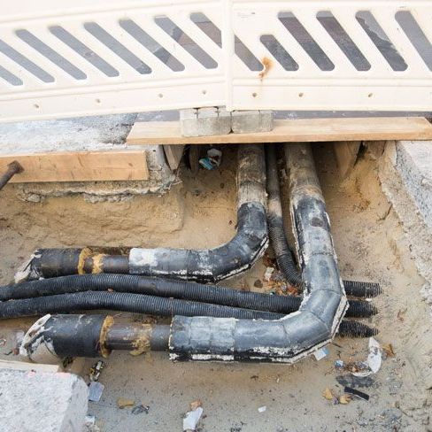
Construction sites can contain electrical cables, communications infrastructure, gas pipelines, water mains, drainage, sewer lines, conduits and private services. Some may follow expected alignments, while others may have been altered, installed at different depths or omitted from older records.
Before You Dig Australia provides plans from participating infrastructure owners, but BYDA also advises that not every asset owner is a member and that the plans received should not automatically be treated as a complete record of everything underground. Its Five Ps framework therefore moves from planning and preparing to electronic locating and potholing where permitted before excavation proceeds.
For projects that need buried infrastructure identified before digging, Smooth Flow Hydro provides underground service locating across Adelaide and regional South Australia.
How are underground services located?
Locating underground services is normally a staged process rather than a single scan of the site. The methods used depend on the utility type, available records, construction materials, ground conditions and the level of certainty required for the work.
1. Utility plans and asset information are reviewed
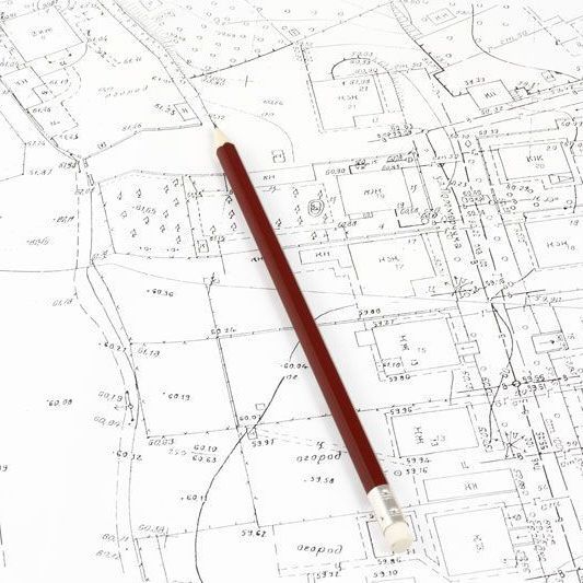
The first step is to collect the information already available about the site. This may include Before You Dig plans, asset-owner drawings, previous survey information, as-constructed records, site plans and project documentation.
These records help identify which infrastructure owners may have assets within the work area and where those assets are expected to run. They are a starting point, not a substitute for site investigation. Plans may be schematic, ground levels may have changed, and undocumented private services may also be present.
2. The site is checked for physical clues
A site walk can reveal evidence of underground services that is not obvious from plans alone. Useful clues include pits, inspection covers, valves, hydrants, meters, marker posts, cabinets, service entries, kerb markings and changes in pavement or ground surfaces that may indicate a previous trench.
SafeWork SA includes visual site inspection as part of its guidance on locating underground utilities. Comparing what is visible on site with the available plans can help identify inconsistencies that need further investigation before excavation begins.
3. Electromagnetic locating may be used
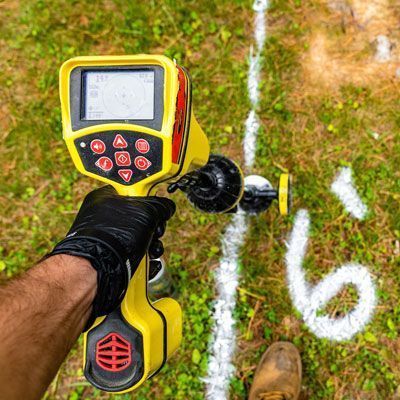
Electromagnetic locating equipment is commonly used to trace conductive underground utilities such as many electrical cables, telecommunications cables and metallic pipes. Depending on the asset and site, a signal may be applied directly to a service, induced onto it or detected passively if the service is already carrying a detectable signal.
The locator follows the signal across the site to estimate the horizontal alignment of the underground asset. Depth estimates may also be available, but they should be treated as part of the locating information rather than as a substitute for physical verification where exact position is critical.
Smooth Flow Hydro provides utility locating services for civil and commercial projects, including work where buried services need to be identified before excavation.
4. Ground penetrating radar may be used where appropriate
Ground penetrating radar, commonly referred to as GPR, is another locating method used to investigate subsurface features. It transmits radar energy into the ground and records reflections created by changes in subsurface materials and structures.
GPR can be useful where an asset does not carry an electromagnetic signal or where the locator needs additional information about what may be beneath the surface. Its effectiveness varies with soil conditions, moisture, depth, material type, surface access and the size of the target, so it is not a universal detection method.
A later guide in this series looks specifically at what GPR can detect underground. For service-locating work, the important point is that GPR and electromagnetic locating can complement one another rather than being interchangeable.
5. Located services are marked on the surface
Once a likely service alignment has been identified, the position can be marked on the ground using the project's agreed marking system. These markings help the excavation team understand where services are expected to run and where additional investigation or controlled excavation may be required.
Markings should remain connected to the underlying locating information. They do not turn an approximate electronic result into a physically confirmed asset location, and site conditions can change between locating and excavation.
6. Potholing can physically verify critical services
Where the exact position of an underground service needs to be known, targeted potholing can expose the asset so its depth, alignment and location can be visually confirmed. BYDA places potholing after planning and preparation in its Five Ps framework and states that it should be completed, where permitted, using the method specified by the relevant asset owner.
Hydro vacuum excavation is one method that may be used for potholing where it is permitted. Pressurised water loosens soil within a controlled area while a vacuum removes the resulting material into a debris tank. Smooth Flow Hydro provides utility excavation services for projects that require controlled excavation around buried infrastructure.
Need underground services located and verified before excavation? Smooth Flow Hydro can support both the locating stage and targeted excavation around selected utilities across South Australia.
What types of underground services can be located?
The most suitable locating method depends on the asset. Common services investigated before excavation include:
- electrical cables
- telecommunications and fibre infrastructure
- gas pipelines and service lines
- water mains and smaller water services
- sewer and drainage infrastructure
- metallic and non-metallic pipes
- conduits and ducts
- private services within commercial, industrial and civil sites
Different assets may require different combinations of plans, electromagnetic locating, GPR and physical verification. For example, Smooth Flow Hydro provides dedicated cable locating services, gas pipe locating and water main locating for relevant project requirements.
What is the difference between locating and potholing?
Locating and potholing answer related but different questions. Electronic locating helps establish where an underground service is likely to run. Potholing physically exposes the service at a selected point so its actual position can be confirmed.
This distinction is important on projects where machinery will operate close to buried infrastructure. A line marked on the surface may represent the best available locating result, but a physically exposed service provides direct confirmation at that particular point.
SafeWork SA describes locating underground utilities as a vital part of avoiding utility strikes and specifically includes cable locating and potholing within its guidance. Its sample permit-to-excavate process also separates whether utilities have been located, marked and potholed within the excavation area.
Can every underground service be detected electronically?
No. Electronic locating has limitations. Some non-metallic pipes may not carry a detectable electromagnetic signal unless they have a tracer wire or another conductive component. GPR performance can also be affected by ground conditions, target depth, soil conductivity, moisture and surface access.
There can also be services that are absent from available plans or infrastructure owned privately rather than by a BYDA member. That is why locating should be treated as an investigative process that combines records, site evidence and multiple methods where appropriate.
If a service cannot be confidently identified, the project team may need additional investigation, asset-owner input or controlled excavation before proceeding in the affected area.
How does service locating support excavation planning?
Locating underground infrastructure before excavation gives the project team better information for deciding where trenches, footings, bores, pits or other works can be positioned. It can also identify locations where the construction sequence should change or where selected assets need to be exposed before larger equipment is brought into the area.
On congested sites, locating can help show how several services relate to one another rather than treating each asset in isolation. This is particularly important where power, communications, gas and water infrastructure occupy the same corridor or cross the proposed excavation path.
Where controlled digging is required after the locating stage, hydro excavation can be used at selected points before broader mechanical excavation proceeds.
What information should be available before a service locator attends?
Providing clear project information can make the locating process more focused. Useful information includes:
- the site address and exact work area
- current BYDA or asset-owner plans
- the proposed excavation, drilling or trenching footprint
- known service connections and visible site infrastructure
- the utilities most relevant to the project
- required excavation depths where known
- areas that cannot be accessed with locating equipment
- site traffic, induction or operational constraints
- any previous locating, survey or potholing information
The more accurately the work area is defined, the easier it is to focus the investigation on infrastructure that may affect the proposed excavation.
Underground service locating across South Australia
Smooth Flow Hydro provides underground utility locating for civil, commercial and infrastructure projects across Adelaide and regional South Australia. The service can be coordinated with hydro excavation and non-destructive digging where selected assets need to be physically exposed after the locating stage.
The appropriate locating method depends on the infrastructure, site conditions and project objective. Plans, electromagnetic locating, GPR and potholing each provide different types of information, and the strongest approach is the one that matches the investigation method to the actual asset and excavation risk.
If you are preparing for excavation and need to establish what services are present beneath the work area, contact the Smooth Flow Hydro team with the site location, proposed scope and available utility information to discuss the locating requirements.
For further guidance, review Before You Dig Australia's Five Ps of safe excavation and SafeWork SA's guidance on working near utility services.